

Trekking in Mt. Kuroso
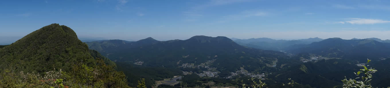
From the left side, Mt. Kuroso, Amagadake, and Obora (photo taken from the top of Mt. Nihonboso)
- Mt. Fuji is occasionally visible on clear days. -
- Mt. Fuji is occasionally visible on clear days. -
Mt. Kuroso (1,037.6 m)
3D Map & altitude
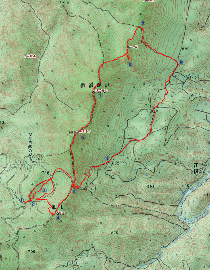
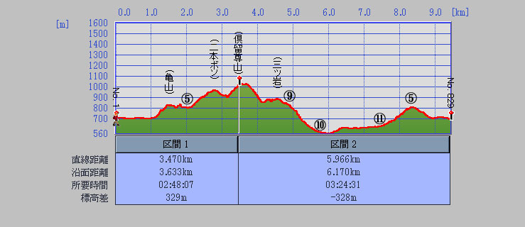
Image provided by Kashmir 3D and e Trex Venture HC (presented by Mr. Shino)